Electrical Resistivity Tomography (ERT) is the most accurate of all electro-resistive methods. It combines the mechanism of electrical resistivity profiling (measurements along the measuring profile) and geoelectric probing (increase of depth range). The method’s operation is based on the measurement of the variation of electrical properties of the medium. They are connected with the diversity of the rock mass. Data acquisition consists in the direct emission of current into the ground by current electrodes and then the measurement of the difference (decrease) of potentials by the measuring electrodes.
The measurement is carried out by creating an electrical circuit in which the function of the “resistor” is assumed by the geological medium. For this purpose, the electrodes which perform both the transmitting and receiving function are placed along the measuring section at equal intervals. The electrodes are connected with each other and the measuring equipment by a multi-conductor cable. This enables simultaneous recording on many channels. The distance between the electrodes along the profile depends on its length, the nature of measurements and the expected depth of data acquisition.
The series of measurements is made on the basis of automatic selection of a combination of 4 electrodes, from all connected to the cable. However, this selection must be in accordance with the set type of measuring system [Wenner, Schlumberger, dipole-axial, triple- and dual-lectrode]. All data concerning the geometry of the spacing, profile length and its parameters are uploaded to the computer before the measurements are taken. The device to which the measuring system is connected, apart from recording the data, also enables continuous quality control of the measurement. This allows the operator to carry out error analysis as well as verification for correct contact of electrodes with the ground. The maximum depth range of the method is about several dozen meters.
Due to the wide range of applications, electrical resistivity tomography is currently one of the most popular geophysical geophysical methods. Geophysical services with the use of electrical resistivity tomography are recommended for exploration and recognition of deposits of metal ores, aggregates and thermal, drinking or medicinal waters. This method is also commonly used in engineering geology to determine the stability of slopes and embankments and to study the condition of landslides. In geotechnical surveys, it is used to determine the technical condition of hydrotechnical and earth structures, as well as to locate collapses or cavities. The electrical resistivity tomography method is also very effective in environmental protection, where it is used to locate sources of pollution and their migration routes.
The collected data is processed by inversion. As a result, resistance models of the medium are obtained. Electrofusion tomography is most often used in the 2D variant which results with a cross-section showing the variability of resistance along the measuring profile together with its depth . The trapezoidal shape of the obtained cross-section results from the decreasing number of measurements with increasing distance between electrodes.
ERT surveys can be also performed in the 3D variant – measurements along multiple profiles, in different directions or using a grid of electrodes. As a result of using the 3D variant, we obtain a three-dimensional geo-electrical model of the medium, which is useful in case of more complicated geological structure. The 3D inversion gives better results, but its execution is also much more time-consuming.
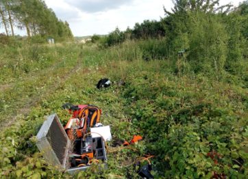
Automatic Resistivity System [GF Instruments]
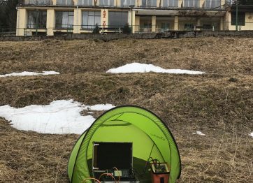
Multifunctional data acquisition system [Phoenix Geophysics Ltd]
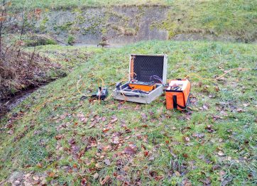
Multifunctional geophysical current source transmitter [Phoenix Geophysics Ltd]
![Przekrój geoelektryczny - tomografia elektrooporowa, electrical resistivity tomography [ERT]](https://geopartner.pl/wp-content/uploads/2020/02/ERT-1-1024x292.jpg)